
The plan to ski across Michigan...
Thu, Dec 19, 2013 - By Dell Todd
Last winter Julian Kuz & I hatched a plan to ski across Michigan self-supported via cache resupply on a horse trail. Here is our story, enjoy reading.
- Departed GR 06:00 Friday February 28
- Arrived Empire 09:30 to spot car. Spoke to ranger @ Sleeping Bear National Lakeshore who said we should see plenty of woodland creatures; wouldn’t rule out bobcat, bear, coyote.
- Set up cache @ Grawn. Made mistake of using cache box 1 in second cache location. Turns out to not matter.
- Set up cache @ Smith Lakes Road, Kalkaska after speaking with Kalkaska DNR - very helpful
- Lunched & drove to Goose Creek CG TH which was unplowed and unparkable. Flailed about for 15 minutes wondering how we were going to start the adventure. Shoveled a space in the snowbank for the car. Phoned DNR Gaylord telling them we were parking there for 3 days - very helpful.
- Began skiing at 13:23 Friday under a clearing bright sky and over a deep snowpack.
- Finished skiing Sunday around 15:15 @ M-37 s/o Grawn @ evac site
- Drove final ~38 miles to Empire by helpful spouse w/warm minivan. Grateful.
- Actually covered 62 miles. Skied 26 hours in 3 days. One fleabag hotel. One bivouac. The bivouac was probably nicer. The hotel was warmer.
Prologue
Julian: “Like most great ideas, this adventure began on a whim. I had found out about the Arrowhead 135 mile race in northern Minnesota through a web site. Snow, skiing through the night, getting lost, frozen toes,maybe -40 degrees. Sounds great! But I needed a partner in crime. I called Dell and talked to him about doing something like this. Alas, the entry was full already for the race. But Dell had a brilliant idea. ‘Let’s do our own thing taking advantage of Michigan’s topography and ski from Lake Huron to Lake Michigan!’ And like most great expeditions, if it can be planned on the back of an envelope, it’s worth doing.
No sooner was the thought planted then we had to figure out what trail system could be used. After hunting the internet, I found the Shore-to-Shore trail - an obscure equestrian trail that crosses the state. Made even more obscure by the fact that the state equestrian group doesn’t really publicize its existence much. But at least we had a route. I bought a map and Dell found a book and we planned what we could given very limited, misleading information contained in both. A few trips up north yielded tantalizing bits of info. Dell even managed a short exploratory mission to guage the trail. His comment: ‘It’s easy to get lost.’ This statement would turn out to be prophetic.
Given the limits of the envelope planning technique, we realized a bit late, that our schedules would not allow a full 230 mile trip. So we settled on half of that. From mid-state to Lake Michigan. Other variables out of our control - me pulling a 36 hour on-call shift at the hospital (because of people putting their hands into moving machines) 2 days before we were to leave, and Dell with work schedule issues - left us both tired, behind schedule, and with reduced hours when it was time to get the show on the road.”
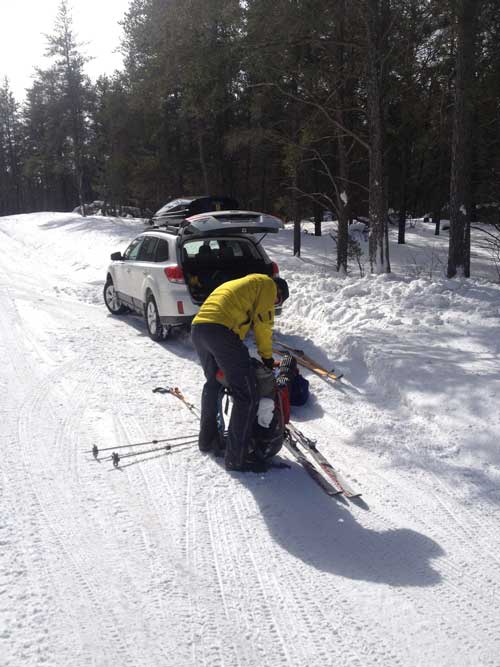
Julian loading his HUGE pack prior to departure, Goose Creek CG, Shore To Shore Trail not too close to Frederic nor Grayling. We shoveled a spot next to the widest part of the road to park the car, leaving it unattended for three days.
We began skiing the trail Friday at 1323 after driving from Grand Rapids to Empire, spotting a car at the Sleeping Bear National Lakeshore. Before skiing, job one was installing hidden resupply caches in the snow near Grawn and Kalkaska. These spots were roughly one third and two thirds of the total trail distance from Goose Creek to Lake Michigan. We conservatively estimated three days for the 100 mile trail distance, allowing a mellow 30 to 40 miles per day skiing all day (“The best laid schemes o’ mice an’ men” -Robert Burns). We travelled light and the caches replenished us with essentials such as dark chocolate, base layers, stove fuel & backpacker food.
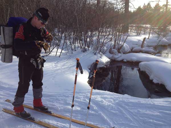
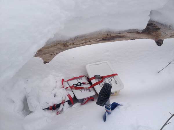
Three shots above of the cache placement near Grawn and the cache near Kalkaska. Caches were buried in the deep snowpack and strapped shut. We labeled them so that nobody would take our dark chocolate. It worked.
Before the actual skiing, the fun task of shoveling out a parking spot at the trailhead for our car was required- another unplanned chore and putting our start on the trail later than anticipated. After all the planning (since before winter), a few training sessions bushwhacking in the woods around Grand Rapids, a few 50k (& shorter) nordic ski races - because that’s what we do - discussions about what to bring and what leave behind and books read on winter camping, we were skiing at last! The sun was out, the snow was deep and a snowmachiner had groomed a trail for us on the non-motorized trail.
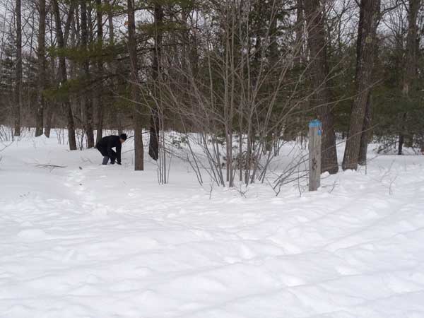
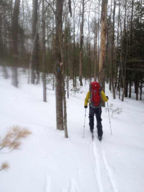
As you can see from the above pics taken during the first hours on the trail, the sun was shining brightly, the mood was pure joy, the living was easy, and the miles were clicking off quickly. Even the hills seemed small but they were pretty big! The trail was impossible to lose due to the skidoo tracks. Little did we know at that point that this would be as good as it gets. The first few hours would be an entirely different character than the other 20+ hours on the trail.
Route finding along the trail is a full time job from which there is no relaxation. The trail, which is deeply troughed in summer by horses hooves was covered completely with snow some of the time making it impossible to divine it’s true location. The trail is marked at irregular intervals by the credit card sized blue plastic blaze you can see above next to Julian. The trail itself varies from completely hidden from sight, to a ditch up a hill deep enough that you cannot see out. Generally the shape of the trail surface is eroded enough that footing is difficult even under the snow. We assumed that the trail should be relatively easy to spot because you have to fit a horse through it in the summertime. However the heavy snows of early winter had bent all nearby saplings over most of the trail. Over time these trees have stiffened to the point that you cannot ski under them to simply push them back up as you pass through. Instead they completely block the trail. The combination of tough footing and tree blockage meant that the majority of travel was not even on the trail, but someplace alongside it, zig-zagging all uphills, breaking through the soft deep snow. None of these conditions made for a fast pace.
On Saturday morning, feeling relatively fresh on day two, needing to make 40 to 45 miles on the day in order to remain on schedule for a three day adventure, we skied vigorously for about 5 hours, having to break trail in deep snow with an unsupportable surface crust. Appalled to discover we had covered a mere dozen miles in that time, we knew then that a 3 day weekend is simply not enough time to cover 100 trail miles in these conditions and we’d need a ride to our car from some point ahead. Below is a picture of a ridiculous yet typical place in the trail that had us puzzling, “Where do the horses go? We aren’t even lost!”
As you can see from the credit card sized blotch of paint on the tree, we are right on the trail. However in person, the trail is completely hidden from view, as is the way forward. So you ski and pretend that you are on the trail. Hours and hours ski past you without a car sighting or even a real road, a house, a town, leaves you thinking, where are we, really? It is good to realize how much of Michigan is still in a state of forest to a large degree. The only delight at times would be spying a blue marker which would relieve the dread of the last 20 minutes that we may have gotten lost.
A chief navigational problem was clearcuts. Those (infrequent) trees with the blue blaze had been harvested. The trees in a planned clearcut are painted either of two colors; red paint tags them for harvest, blue marks them as keepers. Unfortunately, blue being the color of hiking trail markers makes it close to impossible to navigate a clear cut (for years hence). Imagine all remaining trees in the clearcut are marked blue, telling you the proper way forward is right AND left, AND far left and far right...it would simply not be possible to navigate this trail in the dark, and was barely passable during daylight. Julian’s clever & effective strategy was to fan out right and left on the many clearcuts, to determine where to pick up the trail on the opposite side.
That’s when we saw the wolf. Somewhere in the general vicinity south of the Vasa trail around Williamsburg, I was scanning the far edge of the clearcut for blue credit cards nailed to trees when movement caught my eye. I hollered to Julian, “What’s that?! A guy? A sasquatch? A dog? A coyote?” And then it became clear that it was a huge (80 - 100 pound) wolf. He had run away from us along a ridge-top stand of aspens, but then the wolf ran down the ridge toward us into the clearing, spotted us, stopped and looked at us for a few seconds, then bounded back up the hill and again along the ridge away from us. Because of a perfect view, it was possible to definitively identify him as a wolf rather than a common coyote, He was a gorgeous animal, red and grey along the back and also blond down low with a black back. A long tail that was held out (rather than a drooping coyote’s) allowed a good ID also. Looking at one another, humans to canis lupus, unsure of how this would play out was electric. It was an exhilarating moment, made even better realizing that the wolf had run off. Within a mile we skied across a kill site - nothing but blood and fur (They eat everything but fur.) I called the sighting into the DNR who told me that nobody knows how many wolves are in the Lower Peninsula. The Upper Peninsula has hundreds, perhaps too many for ranchers. But in the LP, I suggested maybe we have a dozen? The ranger said maybe we have one or two wolves.
We are pretty sure we also saw a pair of coyotes about as far away as a ski length - in the dark for added sport. We had decided on Friday that because we had started much later than the original plan, and the pace of travel not being what we expected (by half), we would not be near the cache before midnight. Sun had set and the mercury was plummeting. We were getting cold. We were tired. It had been a long day and we figured we were at least 3 hours from the cache. One part of the discussion included the evaluation of whether we had in our packs what we needed for the night. However, we opted for “Camp Visa” in Kalkaska. Only 8 to 10 miles from town on a beeline, we’d already traveled from 16:00 to sunset on ROADS, we figured what’s another couple hours with a warm hotel room as the reward.
The roads we’d been traveling since the trail emerged from the forest around 4 PM were not that bad as these things go. We basically had a seasonal skidoo road, or a small gravel road, with plentiful snow, totally white surface and firm, fast snow for quick travel. We didn’t realize that the pace of travel was about to plummet due to conditions between Decision Hilltop at sunset and town. First we skittered along an icy road shoulder millimeters off the gravel (generally, sometimes less), inches away from the road lane. Then we hopped up on the snow / dirt / salt mix that plows toss to the side of the road. Who knew this is the slowest snow type ever attempted by ski-shod humankind? We only had to take one turn, west toward town and that unfortunately flat road vectored us straight into the traffic light at M-72. Turns out if you are on a flat (flat with a tolerance of +/- 6 inches) road with decent visibility, you can see a traffic light for over 7 miles. At a pace of no more than 3 MPH, you are looking at this traffic light for an excruciating length of time. Ski hard for a half hour - are we any closer? Sorry it doesn’t look like it. Skiing along like this, trying to maintain upbeat demeanors (challenging), we discovered a whiter shade of snow along a wide shoulder, along a stand of white pine trees that lasted over a mile. You could either ski in the slow snirt next to the road or the soft white snow next to the trees. Easy choice. Also easy to notice the millions of animal tracks darting out of the woods towards the street in this area. What were the woodland creatures? Squirrels? Certainly deer tracks are easy to ID and these tracks were on top of the snow, not plunging like the small deer hooves on their spindly legs. Trying not too hard to wonder what beasts made these tracks, the headlamps were reflected back to us from under the pine boughs under our elbows. Julian says, “Those are predator eyes. Front mount. Two pairs.” Instinctively, I calm our group by thinking out loud, “I don’t need to ski faster than the coyotes. I only need to ski faster than you!”

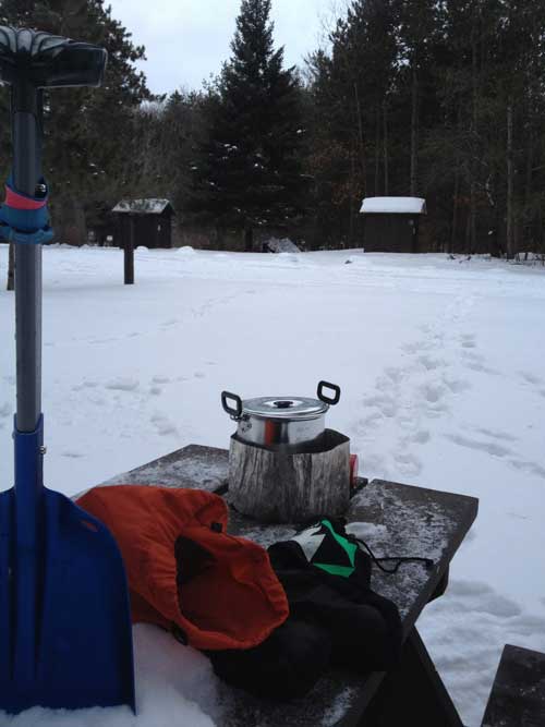
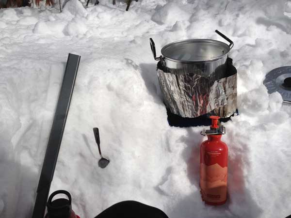
Lunch & teatime above. After hitting the trail hard from 0730 to 1315 and making only a dozen miles, we pulled over and made a footwell/snowcouch and a proper lunch setup! We melted snow, made water, tea & had kung pao chicken & chili bean stew.
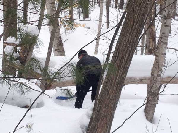 Julian above, with the sweet glow of having survived the stare down of the wolf, and earlier two coyotes. Supply Road near the Williamsburg Road fork. Shore to Shore trail blue marker roadside post. These posts are only seen at road crossings.
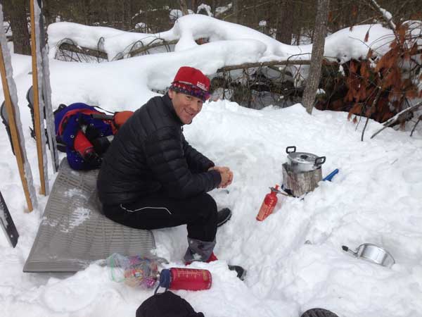
Here we stoped at some open water to refill our nalgene bottles. However this was around 4 PM Friday, sun getting low in the winter sky, and the Shore to Shore trail leaves the forest a few feet behind us and crosses the stream over this bridge. We would not see the forest again till the following morning. We attached Julian’s nalgene bottles to a ski pole and swam it through the water to fill it. Then we were going to use his ultraviolet light sterilizing pen, except we got too dehydrated, cold, tired and apathetic a couple hours after running out of water so we waited too long to use it. Then we finally did, and it was too chilly to function properly, just like us. And the coyotes who passed us up for no reason-perhaps in our pathetic state, we didn’t look very good to them.
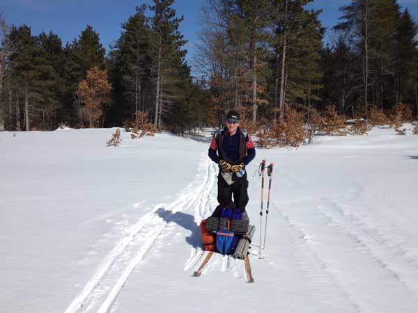
Selective forestry equipment butchered the trail but not for more than about 15 minutes.
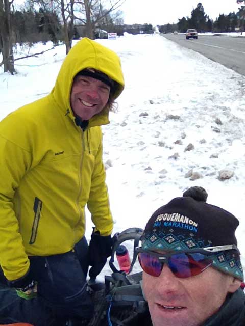
We left not a trace by the way. So here was a first class winter campsite that we stumbled upon about 20 minutes before sunset Saturday. We’d been on the trail from 0730 and we found this gem at 1820. We only covered 23 miles in all that time. By the way the forecast was for clear skies the entire weekend. We did enjoy clear skies from the moment we set out Friday afternoon thru the completion of the day in town at the hotel. We awoke Saturday morning and it was only 18 degrees because it had clouded up overnight. We were relieved because this meant that the forecast was wrong, it would be overcast for the remainder of the weekend and we would be fine sleeping under the stars Saturday night. And a lot of that sentence turned out to be correct.
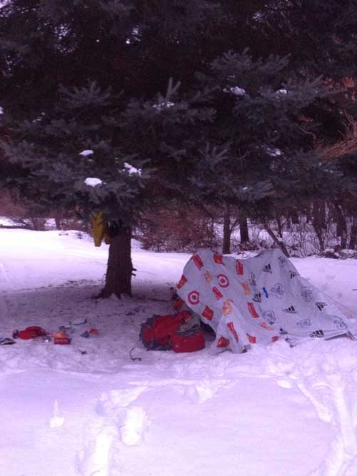
Saturday our goal was to ski to Sheck’s horse camp by lunch and then well on from there towards evening. Ha, we made it to Sheck’s at 1800 hours! Sheck’s is a perfect summertime horse camp the size of a fairground and exactly not what we needed for a cozy winter campsite. We skied down the trail a few minutes, saw some picnic tables through the trees, straightlined it to them and found they were connected to a cozy overnight campground with 6 sites with fire rings, two pit toilets (very nice examples of the breed), a freely running Boardman River and best of all, a functioning hand pump for potable water! (which means you can just drink it without sterilizing it / boiling it). We found that when we stood under the spruce tree in the above picture we felt warmer. So that is where we made camp.
Julian set up two marathon blankets as a windbreak because we’d had a persistent wind all day. After a huge dinner (pad thai, more kung pao chicken, yerba mate tea, and more food that I forget), we bunked down in our bivouac sacks. There was a touch of wind and a bit of a light flurry. Whatever the temperature was at bedtime, we were so comfortable in our sleeping systems that we had to unzip. I think was likely around 15 degrees. All set for a huge sleep, it was only 7:37 PM! I awoke at 04:00 acutely aware that dangerously cold air had already robbed my sleeping system of most of it’s warmth. It was frightfully cold out. I heard Julian zippering and rustling. I called to him that it had gotten a lot colder. He replied that we were under crystal clear skies and a bright moon. The wind was gone as was the bedtime flurry however there was a cold rush of air towards the lowest point around, which was the river. We were about 75 feet off the riverbank and the cold dense air was sinking towards the low spot, the river. It was like a wind, but it was extremely and strangely cold. At the moment I was gripped with concern that this cold air could overwhelm me. We had to hang for a couple hours for sunrise, and all would be forgiven basking in the warm glow of coffee and laughter. However we had to make it to sunrise first. And I was having a difficult time sealing out the cold rush of air. I finally was able to completely overlap the top seams of my bivy sack to stop the flow of air. However, this claustrophobic enclosure is unpleasant and also seals in the vapor that had been venting out. Never mind that vapor would eventually overwhelm the insulation, or the rising carbon dioxide levels in my bivy sack...I also did calisthenic exercises in the bag to generate body heat. I awoke cold regularly. Each time, I vented a tiny bit of fresh cold air into my bivy and also did some cals to warm up. Finally my bivy turned from pitch black to army surplus olive drab! I had survived the night! Julian asked me if 12 hours in the sack was enough! Ha, with that we slowly considered what was required for getting up and facing the bright sunny morning, when we realized that it was snowing. We were robbed of the glorious sunshiny breakfast.
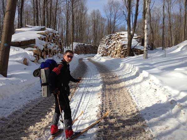
Good morning flurries. That was the coldest night of my life and I’m glad to be alive.
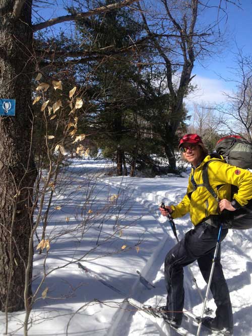
Good morning coffee. Julian brought Starbucks instant coffee sticks. Tiny. Have two. They are fantastic in this situation. They weigh nothing. You have to have something warm in the morning after a night like that. Even though we had placed boots in the bivy sacs, they were frozen. It was excruciatingly slow and painful to squeeze a foot in them but once you got moving, all that was forgotten
The next day was a less than 20 mile blur, but the main thing is this:
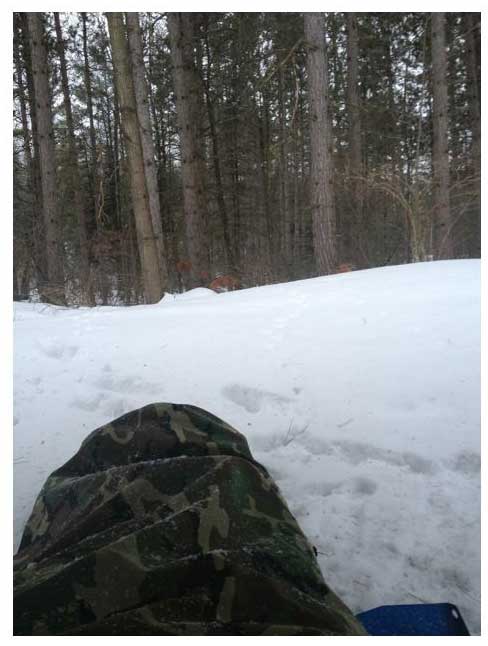
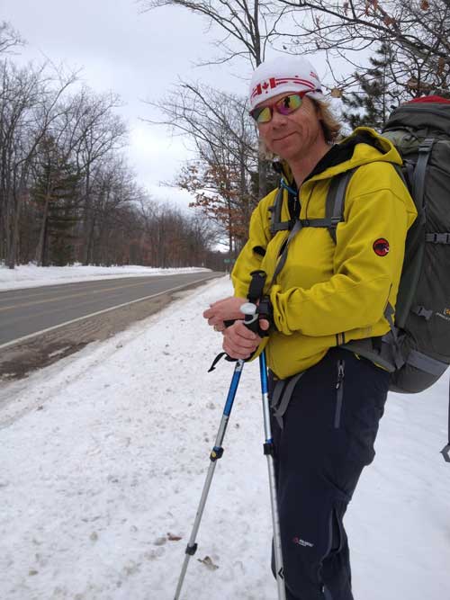
Julian is doing all the smiling but I am really happy too. I just wasn't sure how to push the button with my cold hands! Here we are south of Grawn at M-37 on the Shore to Shore Trail. We emerge as BETTER friends by far! Julian’s family had been skiing at Boyne Mountain and were actually done for the day, so were picked up within the hour. Amazing. Cheryl is amazing and her car was so warm. She told us that morning all the skiers on their way to Boyne saw TEN BELOW on their car thermometers! We were shocked! We knew we had survived a cold night in a 15 degree and a 20 degree bag in a shell bivy, but we didn’t have a temp. Sounds about right.
The next trick took about 7 hours to unwind the caches, pick up the other car and drive home! A small discomforting thought remained. Would the car at the trailhead still be there? Intact? Able to be driven out of the snow? We brought a tow strap just in case but the worry was for naught. All was well with the car.
Trip Tips & Lessons
- Would do it again but not on a horse trail. Freestyle forest travel would even be preferable.
- Camp/trail/gear/food/technique is key
- Probably got lucky with the stove & should order the stove maintenance kit & a teakettle w/a snow lid.
- Just put the duct tape on your heels from the gitgo
- It’s possible to be comfortable far outside the temp rating of your sleeping gear w/technique
Epilogue
Julian:” We were unable to make the full distance because of the technical challenge of a slow pace forced by having to break trail with heavy packs, and getting lost more times than we could count. With more time, we could have soldiered on and finished albeit more physically worn but not broken. A balanced life means that family and work schedules call us out of the woods. Nonetheless, we can consider this a success. We were safe at the end. As with most endurance activities, managing discomfort is the key. We learned a lot and can plan more effectively for the next trip. A sign of success on the mental, physical, and social aspects of this trip was that while waiting roadside for our ultimate rescue, we already began planning the next adventure.
While on the trail, you certainly develop an appreciation for things like electricity and furnaces. However I developed a greater appreciation for the simple life affirming aspects of fulfilling basic necessities, the quiet of the woods, the pleasure of moving under your own power in a deep, still winter setting, a partner that you can trust, and a level of companionship that can only form when having to work together to overcome obstacles.
Too often, in our hectic world, frequently interrupted by the phone and texting, frequently distracted by demands of our work and the day-to-day demands of modern society, we forget these simple things. Still, at times over the cacophony of our modern electronic noise, we can draw back into the memory of being on that snowy trail in the woods and look forward to the next time.”
