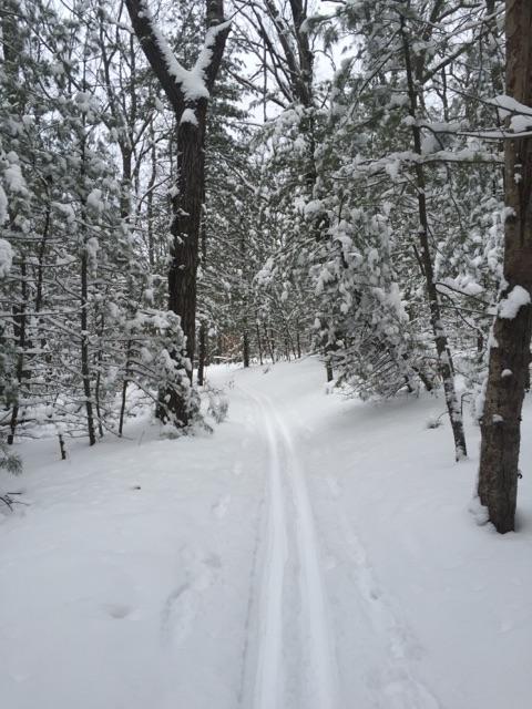
Cadillac Pathway
Cadillac, MI
[email protected] or (231) 775-7911
Trail Length: 11 miles
Groomed Classic? Yes
Groomed Skating? No
Lighted? No
Snowmaking? No
Ski rentals? No
Trail Map: Yes
Getting there: Intersection of Seeley Rd & Boon Rd. A Michigan Recreation Pass is required for parking.
Directions to get there: Yes
Once the snow starts to fly and we have at least 6 inches on the ground, the Friends of the Cadillac Pathway (volunteers) strap on their helmets and jump on a snowmobile to head out and set some of the finest classic cross country skiing tracks you will find in northern Michigan. Starting from the trailhead you can choose distances from just over 1 mile to as many as 11 miles. There are varying levels of terrain encompassing easy, moderate and difficult. The trails that are east of Seeley Rd (nearest the trailhead) will offer up easy to moderate cross country ski trails. Once you cross Seeley Rd and head west the terrain becomes much hillier for the intermediate to advanced skier. There will be something to please the entire family! We recommend that only cross country skiers use the main Cadillac Pathway to preserve the tracks for those two skinny long boards. What if you're not a skier? Then you'll want to check out our new Winter Sports Trail, open to all other users. If snow permits, the trails are groomed at least once a week. Look for detailed grooming reports here on our website and also on our Facebook page.
Located just ten minutes from downtown Cadillac, Michigan, the Cadillac Pathway stretches 11 miles through the Pere Marquette State Forest northeast of the city limits.
Two trailheads with paved parking give the Pathway accessibility. The north trailhead is off Boon Road east of the U.S. 131 Expressway. There is a pit toilet at this parking area. The south trailhead is adjacent to the Wexford-Missaukee Career Technical Center where 13th Street turns into Crosby Road. There are no toilet facilities at this area.
The Pathway’s layout is superb. The North End, which locals call the Deer Loop because of the likelihood of seeing abundant wildlife, consists of mainly flat routes measuring 1, 2.5, and 4 miles. All three loops finish along a scenic section of the Clam River, a free flowing trout stream.
The South End is more difficult. This has loops of 2 and 5 miles and features several hills that are challenging to climb and heart-thumping steep to descend.
The two ends of the trail are knitted together by a connector section (1 mile long each way, down and up). You ski the 4 mile loop at the North End or the 5 mile loop at the South End to access the connector. Skiing the entire Cadillac Pathway, both ends and the connector, is an 11 mile trek.

