
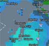
The first major lake effect snow event of the winter will continue to impact Northern Michigan through this evening. Storm total accumulations across much of northwest Lower and the eastern U.P. will likely exceed one foot by Tuesdsay morning, with much less amounts heading toward Saginaw Bay. Snowfall rates will occasionally exceed 1 to 2 inches per hour.
In addition to the heavy snow, blustery northwest winds of 20 to 30 mph with gusts to 40 mph will result in significant blowing and drifting snow, as well as produce blizzard conditions at times with very low visibilities.

Treacherous travel conditions are expected through this evening. Those with travel plans through northern Michigan should keep a close eye on weather conditions, and be prepared for poor road conditions. If you must travel, please remember to slow down and allow extra time to reach your destination.The latest road conditions are always available from the Michigan State Police Winter Travel Advisory Page.